This solution is straightforward yet powerful for the agribusiness sector, enabling the management of field activities through telematics data. The agriculture GPS system provides clear insights into fields, crop rotation, and field operations for both employees and managers of agricultural enterprises. With precise information on who cultivated the crops, when, and how, clients can efficiently plan and enhance their agribusiness processes.
Clients receive precise information regarding the quality and quantity of field operations, along with details about the activities of agricultural vehicles and their operators.
Dependable data
Hitrace assesses the field cultivations of intricate shapes, accounting for omissions, overlaps, and uncultivated sections within the fields.
Automated computations
The solution determines cultivated field areas, fuel usage, distance traveled, speed, and various other metrics, allowing employees to save time.
API connectivity
Export data from Hitrace and utilize it in any accounting systems through API integration.
How the Hitrace fleet digitalization and GPS system works in agriculture
Import geofences as fields; configure trailers, drivers, and units in Hitrace for future use.
Complete the catalogs for crops, operations, and crop rotation.
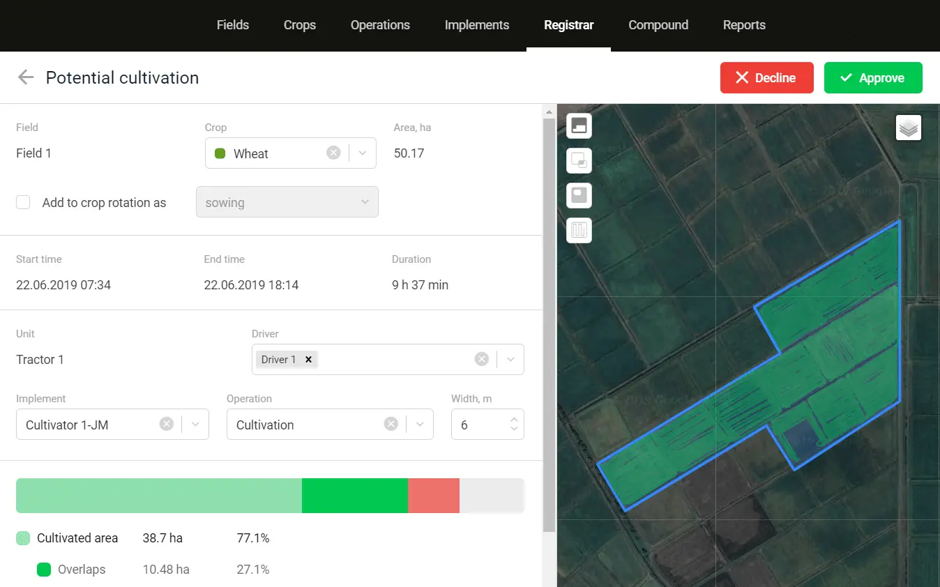
Accept or reject the identified field cultivations.
Create and export detailed reports on field operations.
Features of the Hitrace agricultural GPS system
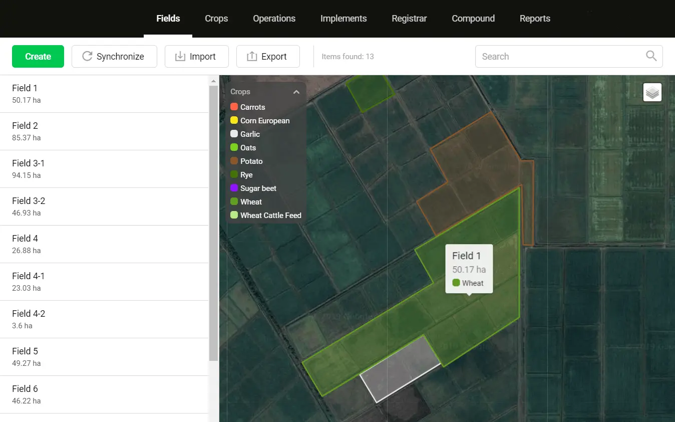
Importing and creating fields. Management of crop rotation, a catalog of crops, and a comprehensive history of cultivation for each field.
Identification of new field crops. Options to modify and authorize the crops prior to their inclusion in the registry.
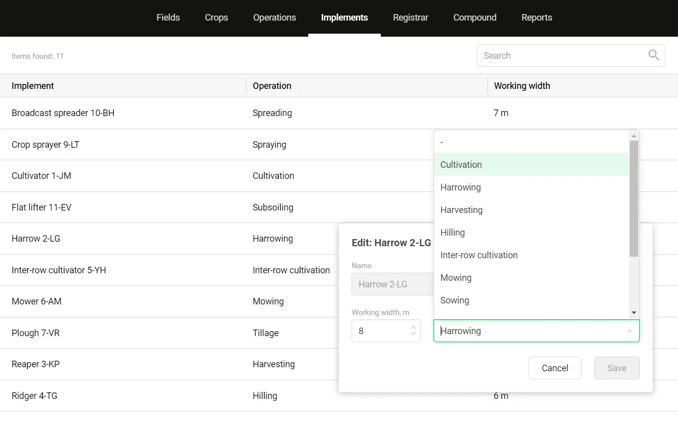
Employing drivers, units, and trailers generated in Hitrace to calculate fuel consumption, speed, and mileage for each field cultivation.
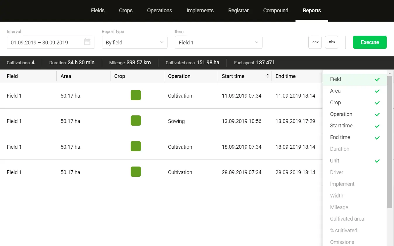
Simple report generation by drivers, fields, operations, or units, with an option for CSV import.